


How wildfires impact Sierra Nevada snowpack
And why you need to understand albedo

Volume 2, Number 35 - Monday, April 8, 2024
Published every Monday and Thursday
Perspective
YOU MAY HAVE HEARD that results from recent snow measurements in the Sierra Nevada were positive. The California Department of Water Resources reported HERE with an article headlined “Two in a Row: April Snow Survey Shows Above Average Snowpack for Second Straight Season.”
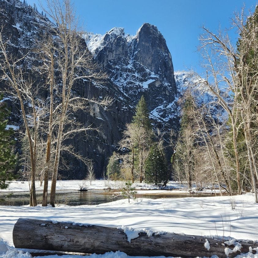
That was very good news for a state that depends upon the Sierra Nevada snowpack for about 30 percent of California’s water needs. Gov. Gavin Newsome even made the trek to the Phillips Station in Northern California for the April 1 snow measure.
Beyond the good news about the snowpack were some other notes in the DWR news release, including the fact that soot and ash from burn scars accelerate snowmelt.
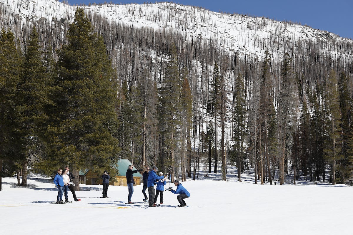
Regular readers will know that a number of megafires have burned in the Sierra Nevada in recent years. According to a January 2022 report from the Sierra Nevada Conservancy HERE, the total acres burned in recent fire seasons are of a magnitude greater than what the Sierra Nevada has experienced over the last 100 years. (The fire seasons of 2022 and 2023 were relatively mild, largely due to lots of rain and snow).
The DWR (and most of us) would like to have the snowpack stay put in the mountains for as long as possible to avoid a fast melt that could lead to flooding. When the snow melts too soon or too fast, we see problems such as flooding and reservoir management is challenged, resulting in less water available for farming and communities.
I was curious about how “soot and ash from burn scars accelerate snowmelt,” so I did a little digging and learned a bit about something called albedo (pronounced al-bee-do). According to Wikipedia, the word derives from the Latin word albedo, meaning “whiteness,” and is the fraction of sunlight that is diffusely reflected by a body.
According to NASA, “Albedo is the fraction of light that a surface reflects. If it is all reflected, the albedo is equal to 1. If 30% is reflected, the albedo is 0.3. The albedo of Earth's surface (atmosphere, ocean, land surfaces) determines how much incoming solar energy, or light, is immediately reflected back to space. This can have an impact on climate.”
NASA further explains HERE, that “albedo is important to Earth scientists because it plays a significant role in our planet’s average surface temperature. When a surface reflects incoming sunlight, it sends the energy back to space, where it doesn’t affect temperature or climate.” Snow darkened by soot or ash doesn’t reflect the energy as well.
According to research published in January 2023, HERE, severe fires alter mountain snowpack processes near and below the treeline in important ways.
Here’s the “plain language summary” prepared by the scientists:
Satellite fire detections indicate substantial increases in wildfire activity in California's snow-covered landscapes during 2020 and 2021, suggesting wildfire is increasingly altering mountain hydrology.
During 2022, a multi-week mid-winter drought, or dry spell, occurred. A meteorologically similar dry spell occurred in 2013, and the 2022 event provides a test case to examine how post-fire changes (canopy loss and deposition of burned dark material on snowpack) alter snowmelt patterns. Using field observations, weather station data, and satellite remote sensing of snow, we find large reductions in snow albedo and canopy cover drove rapid melt during the 2022 dry spell in burned areas whereas during 2013, minimal melt occurred.
The societal connection between mountains and humans will be strained as mountains face increasing climate-related stressors. Midwinter drought, snow loss, and increasing wildfire are expectations of a warming world. Addressing these challenges requires innovative water and forest management paradigms.
Our findings motivate additional research into assessing and planning for post-fire hydrologic changes in snow-dominated landscapes as both wildfire and dry spells will increase in frequency with climate warming.
I have to tell you that I barely understood that plain-language summary. But I get the point that the wildfires that left thousands of acres of charred ground and green forests turned into blackened tree skeletons continue to impact the environment — and people.
The natural range of giant sequoias today just happens to be in the watershed of a state of 39 million or so people — with about 30% of them depending on the Sierra Nevada snowpack.
This is among the reasons management of those forest lands impacts nearly everyone in the state.
And now you can add albedo to your vocabulary!
Coming soon
I’ve wrapped up a road trip and will be busy this week organizing my notes for some articles related to Giant Sequoias, including an interview with Tony Edwards, the new Forest Supervisor at Sequoia National Forest.
Wildfire, water & weather update
Spring break for many schools is either the week before or the week after Easter, and families and others planning trips to see giant sequoias found both weeks disrupted this year.
I wrote a lot about snow above, so I won’t say much more except that I’m always saddened when I hear about people planning a big trip with the goal of seeing these magnificent trees only to have weather, wildfire, or road closures play havoc with their dreams.
Weather also canceled a trash cleanup day planned by Sequoia National Forest at Hume Lake, and there are still plenty of road problems, including rock slides and other issues. And it meant that I couldn’t visit giant sequoias in the mountains during my recent road trip.
As a reminder, in Sequoia and Kings Canyon National Parks, tentatively beginning April 15 through about May 10, significant weekday, daytime closures will go into effect between Hospital Rock and the Giant Forest Museum. During a second four-week phase, tentatively scheduled from May 13 to June 7, weekday, daytime delays should only be about 30 minutes.
Access from Grant Grove in Kings Canyon to the Giant Forest area in Sequoia will be open to visit the General Sherman Tree, Lodgepole, Moro Rock, and more when closures are in effect.
Similar road construction will take place along Mineral King Road, but a start date or schedule has not been set. The current estimate is for work to begin in late April and take about 8 weeks to complete. Road closures with scheduled pass-throughs for residents will be in effect until Memorial Day weekend when access typically reopens for public vehicles during the season. After the Memorial Day weekend, delays should only be about 30 minutes through project completion.
Road construction by Caltrans outside the park on Highway 180 to Cedar Grove is still projected to be completed sometime in June, with the possibility of Cedar Grove reopening shortly after Caltrans repairs are complete.
Weather — The best Sierra Nevada weather forecasts are at NWS Hanford, HERE, and NWS Sacramento, HERE. In Central California, we’re moving from winter weather advisories to forecasts of unseasonably warm weather.
Wildfire — Cartago, California, is about 40 crow miles from the Trail of 100 Giants Trailhead — across the Kern River and some mighty tall mountains. The tiny community on the west side of Owens Lake was evacuated early last Thursday morning because of a wind-driven wildfire. The San Jose Mercury News reported HERE that high winds and abundant fuel contributed to the vegetation fire’s rapid spread. It was reported to have burned about 104 acres.
Did you know you can comment here?
It’s easy to comment on items in this newsletter. Just scroll down, and you’ll find a comment box. You’re invited to join the conversation!
Thanks for reading!
Thanks so much!
Thanks for sharing this, Claudia. It's a great reminder to always practice caution while taking care of everything around us. It feels that the nature community has changed their tune towards wildfires (wherein it used to be perceived as all bad when now, controlled wildfires as they call it, can be beneficial). Your writing is a good refresh.