


Wildfire-watching
(an interesting summer pursuit)

Volume 3, Number 2 - Monday, Aug. 12, 2024
Published every Monday and Thursday
Perspective
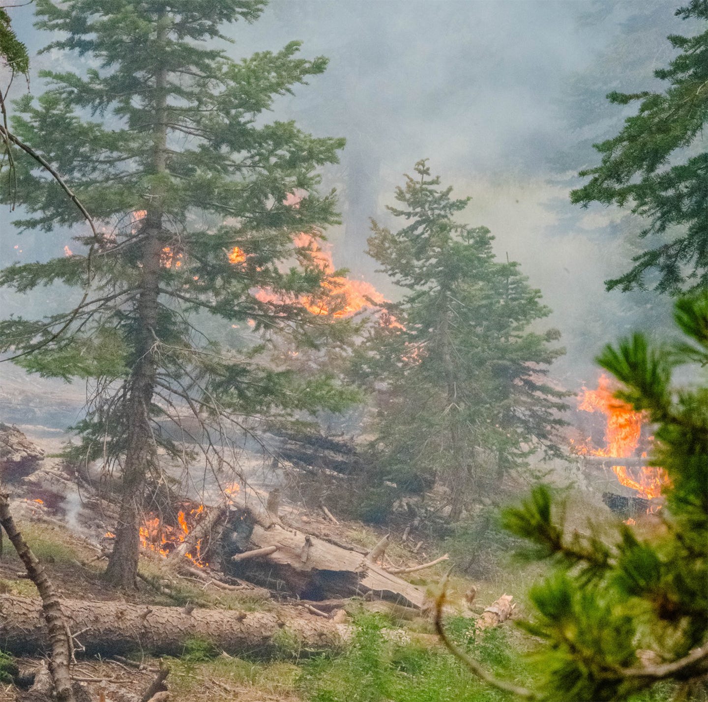
THIS YEAR’S WILDFIRE SEASON, as reported previously, has taken off like, well, wildfire. And it’s not over yet.
People who live in the WUI (wildland urban interface) are beginning to become quite adept at following wildfires that may be near their homes.
As a news reporter in my hometown, Tehachapi, California, I’ve done what I can to inform readers about apps they can use to learn about wildfires near their homes, when and where to evacuate or at least be ready.
Unless a wildfire lasts days (or weeks) and an incident management team takes over, communication about wildfires can be spotty. Even then, the flow of information varies depending on the team. I use several online resources to follow wildfires close to my home, in the Sierra Nevada, and elsewhere.
Social media, including Facebook and X (formerly known as Twitter), is helpful, as is the app WatchDuty. The information there is unofficial and posted by volunteers who listen in on radio transmissions. Sometimes there is minimal information, and sometimes there is lots. I guess it’s the luck of the draw.
When I know a fire is in an area, I also use an app called FlightRadar24. This app allows you to track most aircraft traffic in a specific area. I live near military installations (Edwards Air Force Base and the Naval Weapons Center at China Lake), so sometimes I’m aware of aircraft nearby that don’t show up. Also, I’ve noticed that some small private planes don’t show up on the app.
But when there’s a wildfire, it’s interesting to watch the tiny icons of helicopters, airplanes and tankers working the fire. You can click on one of the icons and see its recent activity as well as where it came from (and, if you keep watching, where it ends up).
On local wildfires, I find that as a reporter I can learn far more about the fire at my computer by using apps and following social media posts than I can getting in my car and trying to chase the fire.
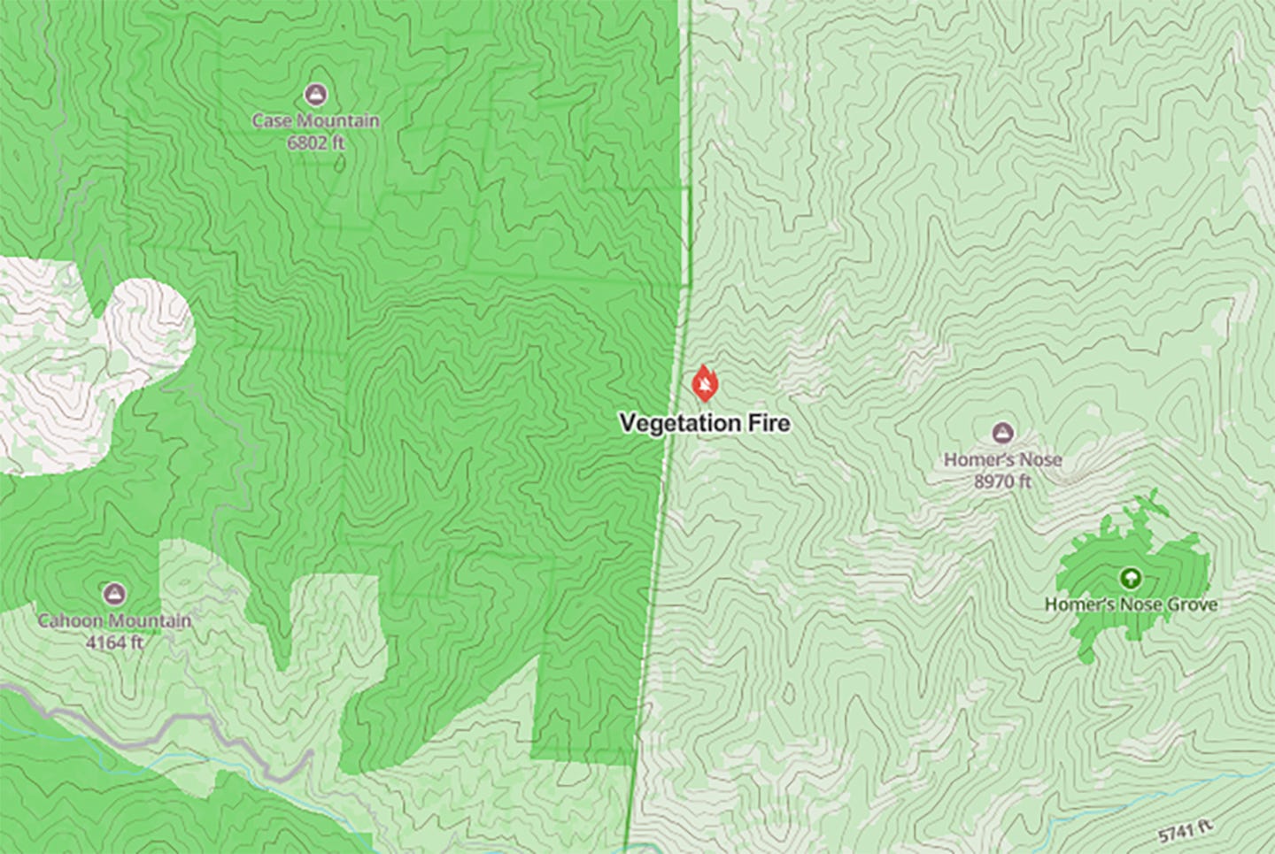
HOMER’S NOSE is the interesting name for a rugged and remote peak in the Sierra Nevada and part of Sequoia National Park. If the map I’m looking at is correct, it’s also part of the John Krebs Wilderness, established in July 2009.
According to the website, summitpost.org, it’s “a very infrequently visited and remote peak in the Sequoia National Park. The peak sees about 3-4 parties a year. Although the peak itself is not a hard climb, it is well known among Sierra Club circles for its long, arduous, brush-heavy approaches.”
The artist Jana Botkin, whose work I admire, has a painting of Homer’s Nose as seen from somewhere in the San Joaquin Valley, probably around Exeter. You can see it HERE.
I mention Homer’s Nose because WatchDuty is showing a vegetation fire identified as “west of Homer’s Nose.” Here’s a map showing the fire’s location:
Just this morning, this fire was named the “Coffee Pot Fire,” as reported by WatchDuty while I was writing this. Cole Euken, a WatchDuty volunteer, just reported: “No additional information has been provided on this incident at this time but air resources continue to work the fire and smoke remains visible.”
You’ll notice that the fire is west of Homer’s Nose and also northwest of Homer’s Nose giant sequoia grove (administered by Sequoia and Kings Canyon National Park. It’s also southeast of Case Mountain giant sequoia grove (administered by the Bureau of Land Management). This area was hammered in the 2020 Castle Fire.
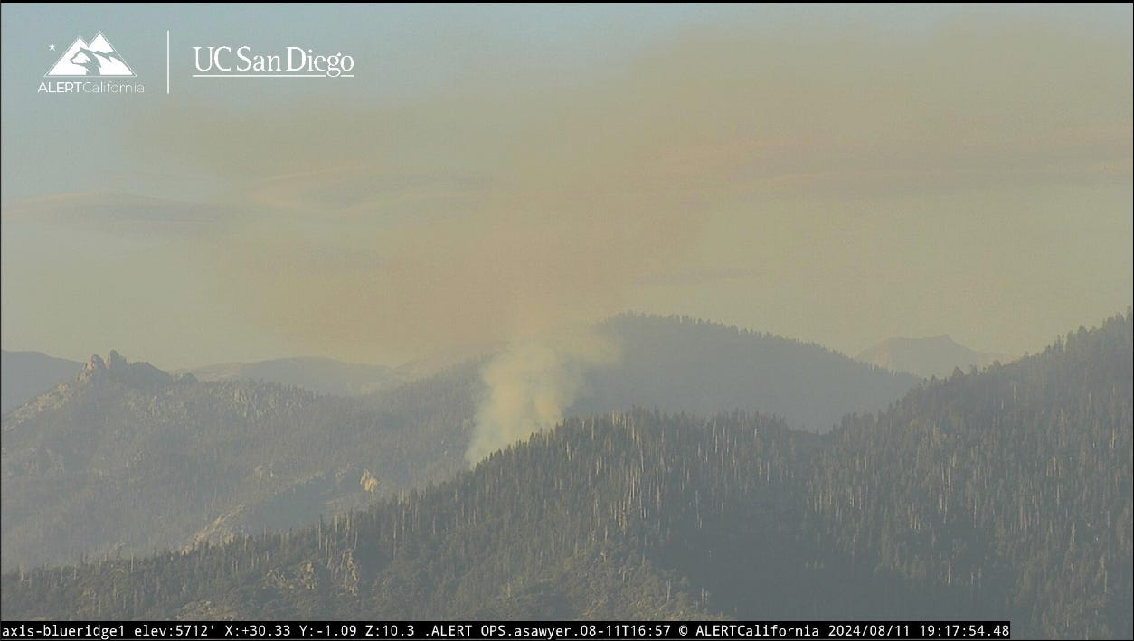
Until the most recent report this morning, WatchDuty called the fire an “Unknown size vegetation fire with smoke visible on the Blue Ridge fire camera. Limited information available at this time.”
Here’s that photo from yesterday evening:
And the latest photo this morning:
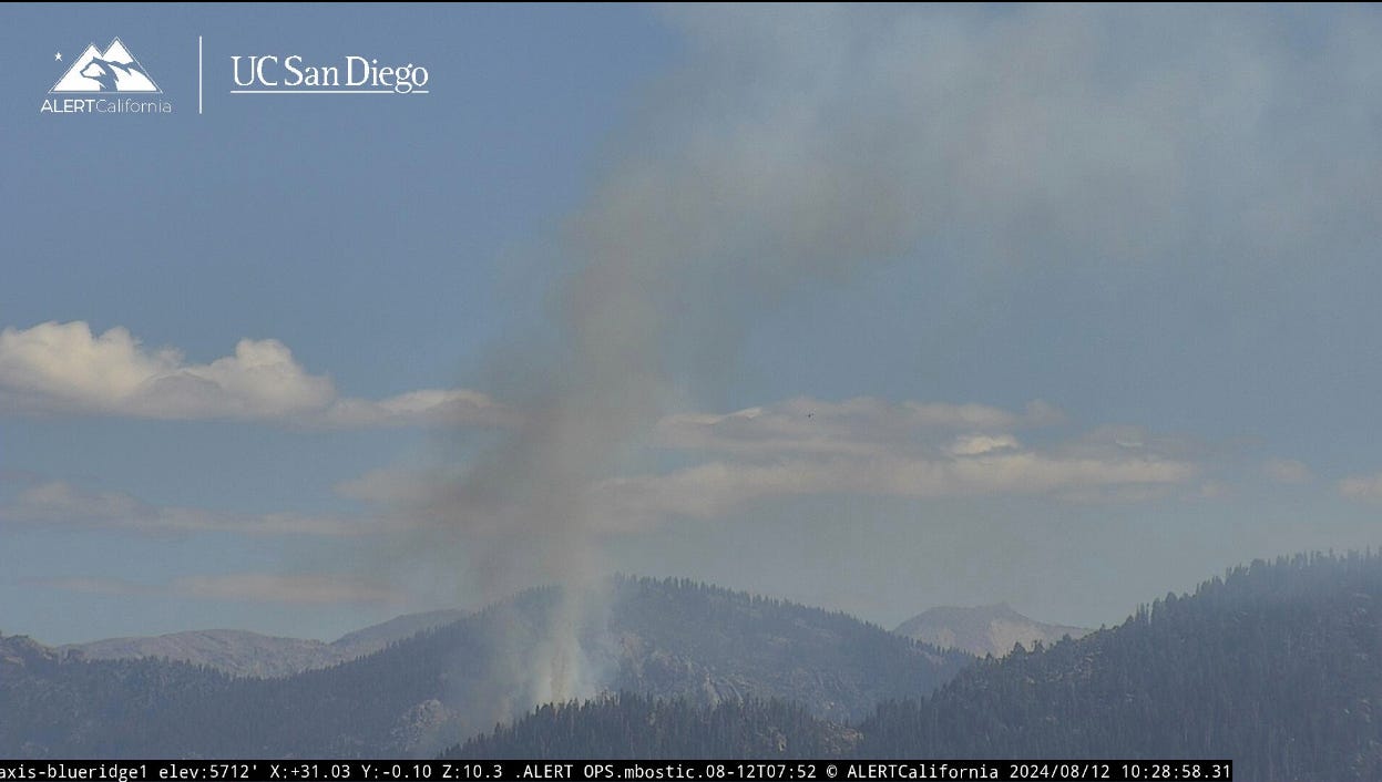
The fire isn’t showing on Inciweb (the federal wildfire tracker) as of the time I posted this. I hope that means it’s insignificant, and land managers believe it will burn itself out. I just checked FlightRadar24 and sure enough, I see aircraft working this fire.
But I’ll keep watching because I’m reminded of a small wildfire I noticed burning in the Kalmiopsis Wilderness in mid-July 2017 when I lived on the southern Oregon coast. I watched and watched, and eventually, that small lightning-caused wildfire in a wilderness area within Rogue River-Siskiyou National Forest became known as the Chetco Bar Fire. Carried by wind, it burned out of the 2002 Biscuit Fire scar and was close to 200,000 acres when it was finally out that November. Part of a stand of coastal redwoods were burned in the fire, along with some homes and damaged or destroyed a number of natural and cultural resources.
I do hope that won’t happen with the Coffee Pot Fire.
A bonus for other wildfire-watchers
If you’re also a wildfire-watcher, you might enjoy this little booklet from Cal Fire showing different types of firefighting aircraft: HERE.
Wildfire, water & weather update
As noted, the app WatchDuty shows there have been a number of wildfires in the Sierra Nevada that so far are very small or have increasing containment. Sequoia National Forest reported great progress on the 2024 SQF Lightning Fires as of this morning, as follows, Trout Fire: 23,597 acres, 70% contained; Long Fire: 9,204 acres, 98% contained; Total personnel: 160.
Relatively cooler weather in the Southern Sierra Nevada this week, with no Red Flag Warnings or Fire Weather Warnings at this time (HERE) as, fortunately, a cooling trend continues. The best Sierra Nevada weather forecasts are at NWS Hanford, HERE, and NWS Sacramento, HERE.
Did you know you can comment here?
It’s easy to comment on items in this newsletter. Just scroll down, and you’ll find a comment box. You’re invited to join the conversation!
Thanks for reading!