Lightning fires trigger evacuations
More than 1,000 lightning strikes in foothills east of Fresno
Volume 2, Number 58 - Thursday, June 27, 2024
Published every Monday and Thursday

Perspective
LIGHTNING STRIKES and lots of fuel are a terrible combination, as we’re seeing in the mountains east of Fresno, California, this week.
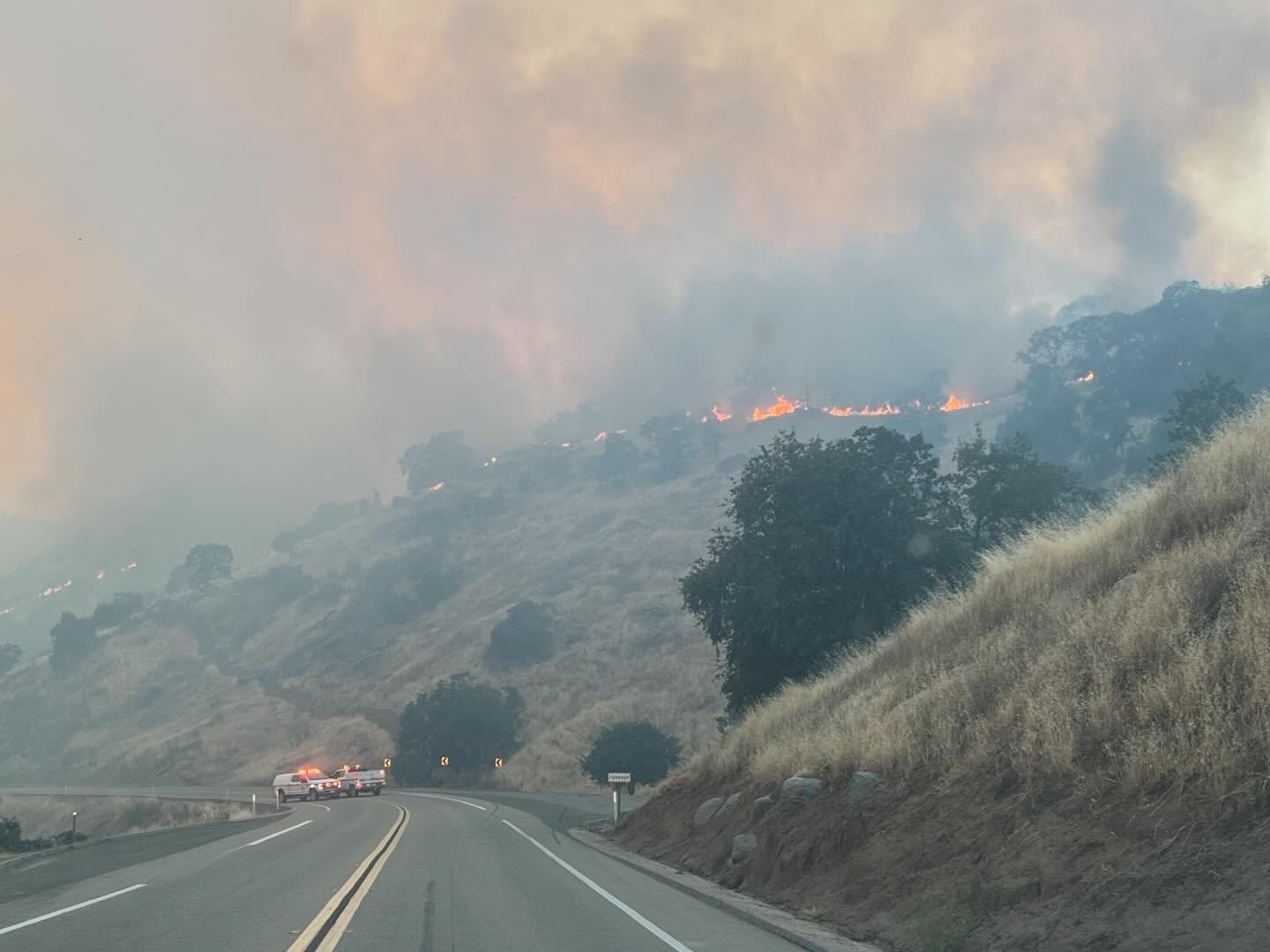
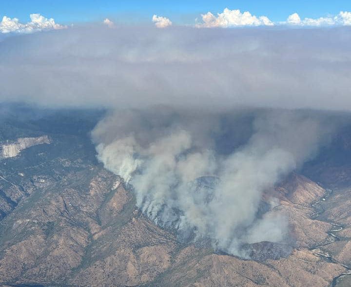
Early Monday evening, CalFire reported that eastern Fresno County had experienced more than 1,000 lightning strikes in a three-hour period. The resultant fires triggered evacuations in some areas. The fires are burning in steep and rugged areas west of Sequoia and Kings Canyon National Parks (SEKI).
Also on Monday, Predictive Services Units from northern and southern California, in coordination with Cal Fire and Cal OES Fire and Rescue Division, issued a Fuel and Fire Behavior Advisory for California’s grass and herbaceous-dominated ecosystems at or below 3,000-foot elevation, including the Sierra Nevada foothills that front areas where most giant sequoias grow.
The Los Angeles Times reported HERE that the dry lightning strikes were related to “lingering energy from Tropical Storm Alberto.” And The Washington Post (gift link HERE), this morning reported on the status of California’s wildfire season:
Already this year, 106,453 acres have burned, most of those since late May. That stands out as “one of the higher amounts of burned area for the first half of the year in the state” in fire records going back to 1972, according to John Abatzoglou, a climatologist and wildfire expert at the University of California at Merced. Last year — a relatively mild fire season — only about 6,871 acres had burned by June 26. While it’s early to know if the notable volume of fires in recent weeks indicates an aggressive fire season ahead, a combination of unusually hot weather and abundant fuel is likely to increase fire risk through the summer.
I rely on internet posts from various sources to gather information about wildfires. I had hoped more would be updated by now, but I suppose the various agencies are dealing with a number of issues, so there isn’t a lot of up-to-date information this morning.
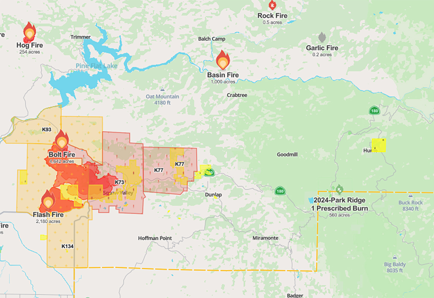
The Sierra Sun Times reported this morning HERE that a Type 1 incident management team is assigned to the Fresno June Lightning Complex. Cal Fire reports that the complex consists of three large fires and several smaller fires. As I write this, the agency reports the complex totals 9,225 acres with 15% containment.
Northeast of those fires, the Basin Fire is burning on the south fork of the Kings River. Sierra National Forest reported on Facebook yesterday that the fire was about 35 acres at noon. The cause of the Basin fire is under investigation, according to CalFire.
Around 8:45 p.m. yesterday, it was more than 1,000 acres with a rapid rate of spread. CalFire currently shows it at 2,636 acres, but it’s a federal fire, so the state agency doesn’t display much information about this fire on its incident tracker. So far today, this fire isn’t showing up on the federal wildfire tracker, inciweb.wildfire.gov/state/california.
Sierra National Forest previously reported that the lightning storm started quite a few fires on its High Sierra Ranger District. Here’s the official report from yesterday:
Fires called out include: Tamarack Fire, Lower Fire, Twin Fire, and Elowin Fire.
Contained wildfires include: Bluff Fire, Basin Fire, Lost Fire, and Tea Kettle Fire.
Resources are on scene of: Snow Fire, Corral Fire, Garlic Fire, Dalton Fire, Fur Fire, Mount Tom Fire, and Patterson Fire.
Forest lookouts, air attack, fire personnel, and forest managers are actively patrolling and looking for any new smokes that may appear. Off-forest resources, including Forest Service engines, crews, and smoke jumpers, have arrived to assist, and more resources are en route for tomorrow’s staffing needs. These crews will actively suppress wildfires, extinguish known fires, and patrol for any new starts.
By my reckoning, based on available information, this fire is burning about eight miles south of the McKinley giant sequoia grove on Sierra National Forest.

Park Ridge prescribed burn update
On Sunday, before the lightning strikes, SEKI began the Park Ridge prescribed burn I wrote about Monday. The burn, in Kings Canyon National Park, is just below the Tulare-Fresno county line and to the east of the lightning complex fires. Those fires, by the way, resulted in the closure of Highway 180, the northern route into SEKI.
Mike Theune, regional fire information officer for the National Park Service, just called me in response to a note I sent last night. I wondered if the nearby fire activity had created any issues with the prescribed burn.
“It didn’t have a direct impact, but was something that we were in coordination with other agencies on,” he said.
In fact, the operation went so well that the NPS is pivoting to move forward with another planned project, the 126-acre Big Stump East burn.
Here’s this morning’s official report from the NPS:
Ignition operations for the Park Ridge Prescribed Burn have successfully concluded, covering 560 acres. The dedication of the firefighters involved in this operation is commendable. Now that ignition operations are finished, the focus shifts to mopping up and securing the holding lines.
As the fire continues to burn through targeted fuels within the designated area, residents and visitors should anticipate ongoing flames and smoke within the burn footprint. This controlled process is essential for reducing excess vegetation and minimizing potential wildfire risks. Smoke will persist in the vicinity of Highway 180 and General Highway. Following the completion of the Park Ridge Prescribed Burn, fire management officers are looking to proceed with the burn plan and start on the Big Stump East project starting (tomorrow) in the Grant Grove Area of Kings Canyon National Park. Given recent lightning storms and nearby fires, leaders and fire management staff at Sequoia and Kings Canyon National Parks remain vigilant and maintain close coordination with neighboring fire agencies throughout the execution of the 126-acre Big Stump East, scheduled to be completed in one day.

Record Rx burning by Forest Service in California
The Forest Service's Pacific Southwest Region reported on Facebook Tuesday that as of 10 a.m. Monday, the 18 national forests in California had collectively treated 63,878 acres with prescribed fire. The previous record was set in 2018, when 63,711 acres were treated.
Wildfire, water & weather update
CalFire’s incident map is (HERE). Today, the weather is relatively cooler in Central California, but forecasts show more triple-digits on the way. Heat in the San Joaquin Valley and the upcoming July 4 holiday are likely to send more people to the mountains, making fire safety extremely important. The best Sierra Nevada weather forecasts are at NWS Hanford, HERE, and NWS Sacramento, HERE.
Did you know you can comment here?
It’s easy to comment on items in this newsletter. Just scroll down, and you’ll find a comment box. You’re invited to join the conversation!
Thanks for reading!


Inciweb is great for large fire info and "public consumption" - however it needs to be fed info by PAOs/PIOs.
There are other things to look at - the Enterprise Geospatial Portal (egp.nwcg.gov) and Risk Management Dashboard are two places to see "incipient" incidents fed by IRWIN ("dispatch SkyNet") and will give you a data dump that will at least give you location, jurisdiction, size, etc.
DM me if you want to chat sometime on how all this works from any angle you want to look at it from - the ONLY things i haven't done in wildland fire are jump from an airplane/rappel from a helo, and drive a bulldozer.
I might have started as an Apprentice, but I'm a Craftsman now. 😉